




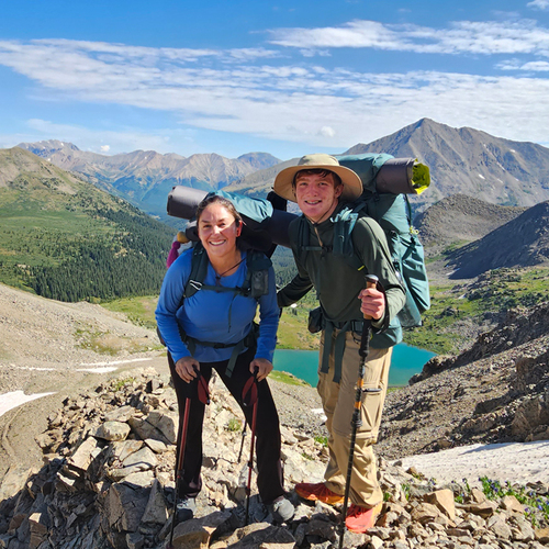


This album contains some of the images that we captured in our backpacking adventure on the John Muir Trail. Some information if you are curious:
What is it?
Length: About 211 miles (340 km) from Yosemite Valley to Mount Whitney (the highest peak in the contiguous U.S.).
Elevation Gain: Roughly 47,000 feet total.
Route:
Starts at Happy Isles in Yosemite National Park.
Travels through:
Yosemite National Park
Ansel Adams Wilderness
Sequoia National Park
King's Canyon National Park
Ends at the summit of Mount Whitney (14,505 ft / 4,421 m).
Why is it popular?
Incredible alpine scenery: granite cliffs, alpine lakes, meadows, and dramatic peaks.
A wilderness experience — much of it is remote and pristine.
Named after John Muir, a naturalist and advocate for wilderness preservation.
Logistics
Permits are required and very competitive.
You need to be prepared for altitude, wildlife (bears), and changing weather.
Most hikers go north to south (Yosemite ? Whitney), though some go the other way.
What is it?
Length: About 211 miles (340 km) from Yosemite Valley to Mount Whitney (the highest peak in the contiguous U.S.).
Elevation Gain: Roughly 47,000 feet total.
Route:
Starts at Happy Isles in Yosemite National Park.
Travels through:
Yosemite National Park
Ansel Adams Wilderness
Sequoia National Park
King's Canyon National Park
Ends at the summit of Mount Whitney (14,505 ft / 4,421 m).
Why is it popular?
Incredible alpine scenery: granite cliffs, alpine lakes, meadows, and dramatic peaks.
A wilderness experience — much of it is remote and pristine.
Named after John Muir, a naturalist and advocate for wilderness preservation.
Logistics
Permits are required and very competitive.
You need to be prepared for altitude, wildlife (bears), and changing weather.
Most hikers go north to south (Yosemite ? Whitney), though some go the other way.