Free Shipping in Continental USA & Canada -
No Extra fees
LOGIN
EN |
FR
FRANCAIS
$
FORMATS & PRICES
ART GALLERY
ABOUT US
TOOLS
SUPPORT
PRO & ARTISTS
CONTACT US
HOME
COLLECTION
SCENIC
AI WALL ART GENERATOR
LIFESTYLE
BEST SELLERS
LANDSCAPES
VINTAGE POSTERS
1X COLLECTION
BOTANICAL
MINIMALISM
OLD MASTERS & POPULAR PAINTING
WILDLIFE
CITYSCAPES
TYPOGRAPHY
POP
STYLES
ABSTRACT
AI
AIGALLERY
DRAWINGS-ABSTRACT
DRAWINGS-FINEART
DRAWINGS-GRAFFITI
DRAWINGS-ILLUSTRATION
PAINTING
PHOTOGRAPHY-ABSTRACT
PHOTOGRAPHY-LANDSCAPE
PHOTOGRAPHY-PORTRAIT
PHOTOGRAPHY-SURREALISM
VINTAGE-POSTERS
FEATURED
BEST SELLERS
EXPLORE
ROOMS
Bar
Basement
Bathroom
Bedroom
Dining Room
Game Room
Garage
Gym
Hallway
Kid's room
Kitchen
Living room
Nursery
Office
ARTISTS
SELL YOUR ART
MY CART
View Cart
Checkout
COLLECTION
STYLES
FEATURED
TOP SALES
EXPLORE
ROOMS
ARTISTS
SELL
SCENIC
AI WALL ART GENERATOR
LIFESTYLE
BEST SELLERS
LANDSCAPES
VINTAGE POSTERS
1X COLLECTION
BOTANICAL
MINIMALISM
OLD MASTERS & POPULAR PAINTING
WILDLIFE
CITYSCAPES
TYPOGRAPHY
POP
Bar
Basement
Bathroom
Bedroom
Dining Room
Game Room
Garage
Gym
Hallway
Kid's room
Kitchen
Living room
Nursery
Office
ABSTRACT
AI
AIGALLERY
DRAWINGS-ABSTRACT
DRAWINGS-FINEART
DRAWINGS-GRAFFITI
DRAWINGS-ILLUSTRATION
PAINTING
PHOTOGRAPHY-ABSTRACT
PHOTOGRAPHY-LANDSCAPE
PHOTOGRAPHY-PORTRAIT
PHOTOGRAPHY-SURREALISM
VINTAGE-POSTERS
Collection
by Style
by Shape
by Color
by Room
Artists
COLLECTION
Scenic
AI Wall Art Generator
Lifestyle
Best Sellers
Landscapes
Vintage Posters
1X Collection
Botanical
Minimalism
Old Masters & Popular painting
Wildlife
Cityscapes
Typography
Pop
Filter by Style
Abstract
(119.2k)
Ai
(84.2k)
AIGALLERY
(29.2k)
drawings-abstract
(19.5k)
drawings-fineart
(25k)
drawings-graffiti
(2.6k)
drawings-illustration
(57.8k)
painting
(232k)
photography-abstract
(38.4k)
photography-landscape
(306.9k)
photography-portrait
(38.2k)
photography-surrealism
(21.3k)
Vintage-Posters
(51k)
Filter by Shape
Landscape
Panoramic
Vertical
Square
Filter by Color
Filter by Room
Bar
Basement
Bathroom
Bedroom
Dining Room
Game Room
Garage
Gym
Hallway
Kid's room
Kitchen
Living room
Nursery
Office
Art Selection for Resellers
sort by:
Featured
Most Popular
Most Liked
Most Recent
Keyword: geographic
×
Oceanic Journey: A Ship Passing Over a Realistic Sea Map
ClikChik
Maritime Realism: Blending Sea and Geography in Art
ClikChik
Global Voyage: A Cargo Ship Sailing Over the World Map
ClikChik
Global Voyage: A Cargo Ship Sailing Over the World Map
ClikChik
Global Voyage: A Cargo Ship Sailing Over the World Map
ClikChik
Innovative Horizons: Cargo Meets World in a Stunning Visual
ClikChik
6
1929 Historical Map of New York State – Vintage Early 20th Century Map Depicting Counties Cities Railroads and Topography Across New York During a Period of Political and Geographic Detail
History In Your Home
Rocky Cascades Moon River Falls III
Deb Oppermann
1902 Map of Madrid Spain – Early 20th-Century Urban Map Depicting Streets Districts Landmarks and Urban Features Reflecting City Planning Colonial Influence and Geographic Knowledge of Spain’s Capital City
History In Your Home
1893 Educational Chart of Global Mountains Highlighting Major Ranges Peak Elevations and Geographic Locations for Use in 19th Century Classrooms
History In Your Home
1953 Map of Cairo Egypt – Mid-20th-Century City Map Depicting Streets Districts Monuments and the Nile River Reflecting Urban Development Political Context and Geographic Features of Egypt’s Capital
History In Your Home
6
Map of New Zealand South Island Te Waipounamu – Indigenous and Colonial Geographic Features Including Maori Names Mountains and Early Settlements
History In Your Home
1840 Map of Egypt – Early 19th-Century Map Depicting the Nile River Cairo Alexandria and Ancient Sites Reflecting Geographic Exploration Ottoman Administration and European Interest in North African History and Civilization
History In Your Home
1897 Map of Hidalgo Mexico – Late 19th Century Map Depicting Political Divisions Towns Cities Roads Rivers and Geographic Features Across Hidalgo State in Mexico Including Topographic and Urban Details
History In Your Home
6
1931 Pictorial Map of Mexico – Vintage Illustrated Cultural Map | Historic Representation of Mexican History Traditions and Geographic Features in a Decorative Artistic Cartographic Style
History In Your Home
1866 Map of the Hudson River – Detailed 19th-Century Map Depicting the River’s Course Surrounding Towns Tributaries and Geographic Features Reflecting Industrial Growth Transportation and Historical Cartography in New York
History In Your Home
1935 Map of Catalonia – Early 20th-Century Map Depicting Cities Towns Rivers Roads and Regional Borders Reflecting Geographic Knowledge Political Divisions and Historical Cartography of Northeastern Spain
History In Your Home
1839 Map of Western Australia – Early Colonial Cartographic Print Depicting Settlements Topography and Geographic Knowledge During British Expansion and Exploration of Australia
History In Your Home
1902 Map of the Seminole Nation Lands in Indian Territory – Historical Map Depicting Tribal Boundaries Settlements Rivers and Roads Reflecting Federal Policies and the Geographic Distribution of the Seminole People
History In Your Home
1975 Map of Cook County Illinois – Detailed Map Depicting Municipalities Roads Railways Rivers and Urban Layout Reflecting Mid-20th-Century Urban Planning Demographics and Geographic Features of the Chicago Metropolitan Area
History In Your Home
1801 Map of Massachusetts Showing Towns Counties and Geographic Features During the Early Federal Period of American Nation-Building
History In Your Home
1901 Map of the Creek Nation Indian Territory – Historical Map Depicting Tribal Lands Settlements Rivers and Roads Reflecting Federal Policies Land Allotments and the Geographic Distribution of the Creek People
History In Your Home
1876 Map of Mont Blanc – Nineteenth-Century Scientific Topographical Map of Western Europe’s Tallest Mountain Featuring Elevation Contours Glacial Zones and Expedition Routes
History In Your Home
6
1908 Map of Paraguay – Vintage Early 20th Century South America Map Reproduction | Historic National Cartography Featuring Departments Cities & Geographic Borders
History In Your Home
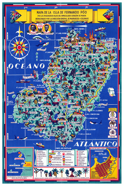
Pictorial Map of Fernando Po Equatorial Guinea – Decorative Map Illustrating the Island of Bioko with Colonial-Era Annotations of Spanish Influence Indigenous Culture and Geographic Features
History In Your Home
1726 Map of Mauritius – Early 18th Century Map Depicting the Island of Mauritius Its Coastal Features Towns Topography Maritime Routes and Geographic Context Within the Indian Ocean Reflecting Colonial Cartography of the Period
History In Your Home
6
1925 Map of Togo – Vintage Colonial-Era West Africa Map | Historic French and German Colonial Borders Towns and Geographic Features of Togo Before Independence
History In Your Home
1801 Map of New York State – Early 19th-Century Map Depicting Counties Towns Rivers and Roads Reflecting Post-Revolutionary Cartography Settlement Patterns and Geographic Knowledge in the Empire State
History In Your Home
Visual venture
Jorgo
1992 Map of Kyiv Oblast – Modern Map Depicting Cities Towns Roads Rivers and Administrative Divisions Reflecting Post-Soviet Geographic Knowledge Political Boundaries and Regional Development in Central Ukraine
History In Your Home
1666 Van Loon Folio Chart of the Island of California – Classic 17th-Century Cartographic Myth Depicting California as an Island with Coastal Profiles Navigation Routes and Early European Geographic Misconceptions
History In Your Home
1901 Map of Delos Greece – Detailed Historical Map Depicting Streets Temples Ruins and Harbor Layout Reflecting Archaeological Knowledge Urban Layout and Geographic Features of the Ancient Island in the Cyclades
History In Your Home
1568 Paolo Forlani World Map Depicting Early Renaissance Geographic Knowledge With Continental Shapes Sea Monsters and Decorative Elements from 16th Century Europe
History In Your Home
1908 Map of the White Earth Indian Reservation – Detailed Map Depicting Tribal Boundaries Settlements Rivers and Roads Reflecting Federal Policies Geographic Distribution and the History of the White Earth Ojibwe Community
History In Your Home
6
1908 Map of the Philippines – American Colonial-Era Territorial Map Displaying Provincial Divisions Maritime Routes and Geographic Features During the Early U.S. Occupation After the Spanish-American War
History In Your Home
1962 Map of Costa Rica – Cold War-Era Central America Map Featuring Provinces Cities National Parks & Geographic Borders
History In Your Home
1796 Map of Virginia – Late 18th Century Map Depicting Virginia’s Counties Towns Rivers Roads and Topography Reflecting Political and Geographic Divisions During the Post-Revolutionary Era
History In Your Home
1853 Map of Louisiana – Mid-19th-Century Map Depicting Parishes Towns Rivers Roads and Geographic Features Reflecting Political Boundaries Settlement Patterns and Transportation Networks in Antebellum Louisiana
History In Your Home
6
Central highlands of Tasmania
Jorgo
Luxury World Wall Art
yaser ameen
1917 Map of Arkansas Showing County Lines Railroads and Geographic Features During Early 20th Century State Development
History In Your Home
1859 Map of Bolivia – Mid-19th Century Map Showing Topography Cities Rivers Roads Administrative Divisions Mining Regions Indigenous Territories and Geographic Features Across Bolivia
History In Your Home
Print One
Plant One
One tree planted for every print.
Pictorem supports Trees for the Future, a 501(c)3 non-profit organization, that operates an agroforesty program to restore trees to degraded lands by working with smallholder farmers.
MORE INFO
EMAIL
PASSWORD
CREATE AN ACCOUNT
FORGOT YOUR PASSWORD?
×
CREATE ACCOUNT
USERNAME
EMAIL
PASSWORD
CONFIRM PASSWORD
ALREADY HAVE AN ACCOUNT?
FORGOT YOUR USER ACCOUNT DETAILS?
USERNAME OR EMAIL
AAH, WAIT, I REMEMBER NOW!
×
TOP
Send
Please wait...