Free Shipping in Continental USA & Canada -
No Extra fees
LOGIN
EN |
FR
FRANCAIS
$
FORMATS & PRICES
ART GALLERY
ABOUT US
TOOLS
SUPPORT
PRO & ARTISTS
CONTACT US
HOME
COLLECTION
SCENIC
AI WALL ART GENERATOR
LIFESTYLE
BEST SELLERS
LANDSCAPES
VINTAGE POSTERS
1X COLLECTION
BOTANICAL
MINIMALISM
OLD MASTERS & POPULAR PAINTING
WILDLIFE
CITYSCAPES
TYPOGRAPHY
POP
STYLES
ABSTRACT
AI
AIGALLERY
DRAWINGS-ABSTRACT
DRAWINGS-FINEART
DRAWINGS-GRAFFITI
DRAWINGS-ILLUSTRATION
PAINTING
PHOTOGRAPHY-ABSTRACT
PHOTOGRAPHY-LANDSCAPE
PHOTOGRAPHY-PORTRAIT
PHOTOGRAPHY-SURREALISM
VINTAGE-POSTERS
FEATURED
BEST SELLERS
EXPLORE
ROOMS
Bar
Basement
Bathroom
Bedroom
Dining Room
Game Room
Garage
Gym
Hallway
Kid's room
Kitchen
Living room
Nursery
Office
ARTISTS
SELL YOUR ART
MY CART
View Cart
Checkout
COLLECTION
STYLES
FEATURED
TOP SALES
EXPLORE
ROOMS
ARTISTS
SELL
SCENIC
AI WALL ART GENERATOR
LIFESTYLE
BEST SELLERS
LANDSCAPES
VINTAGE POSTERS
1X COLLECTION
BOTANICAL
MINIMALISM
OLD MASTERS & POPULAR PAINTING
WILDLIFE
CITYSCAPES
TYPOGRAPHY
POP
Bar
Basement
Bathroom
Bedroom
Dining Room
Game Room
Garage
Gym
Hallway
Kid's room
Kitchen
Living room
Nursery
Office
ABSTRACT
AI
AIGALLERY
DRAWINGS-ABSTRACT
DRAWINGS-FINEART
DRAWINGS-GRAFFITI
DRAWINGS-ILLUSTRATION
PAINTING
PHOTOGRAPHY-ABSTRACT
PHOTOGRAPHY-LANDSCAPE
PHOTOGRAPHY-PORTRAIT
PHOTOGRAPHY-SURREALISM
VINTAGE-POSTERS
Collection
by Style
by Shape
by Color
by Room
Artists
COLLECTION
Scenic
AI Wall Art Generator
Lifestyle
Best Sellers
Landscapes
Vintage Posters
1X Collection
Botanical
Minimalism
Old Masters & Popular painting
Wildlife
Cityscapes
Typography
Pop
Filter by Style
Abstract
(119.2k)
Ai
(84.2k)
AIGALLERY
(29.2k)
drawings-abstract
(19.5k)
drawings-fineart
(25k)
drawings-graffiti
(2.6k)
drawings-illustration
(57.8k)
painting
(232k)
photography-abstract
(38.4k)
photography-landscape
(306.9k)
photography-portrait
(38.2k)
photography-surrealism
(21.3k)
Vintage-Posters
(51k)
Filter by Shape
Landscape
Panoramic
Vertical
Square
Filter by Color
Filter by Room
Bar
Basement
Bathroom
Bedroom
Dining Room
Game Room
Garage
Gym
Hallway
Kid's room
Kitchen
Living room
Nursery
Office
Art Selection for Resellers
sort by:
Featured
Most Popular
Most Liked
Most Recent
Keyword: Survey
×
6
1892 Scientific Survey Map of Death Valley – 19th Century U.S. Geological and Topographic Map Depicting Elevation Desert Terrain and Natural Features of the American West
History In Your Home
17th Century Down Survey Map of Ireland – Post-Cromwellian Land Survey Depicting Irish Land Seizures and Redistribution Under English Rule Following the Wars of the Three Kingdoms
History In Your Home
6
1885 Map of the Rocky Mountains – Topographical and Geographical Survey Depicting Elevations Rivers and Exploration Routes Across the Mountain Backbone of the American West
History In Your Home
1942 Map of Nablus – Historic British Mandate Survey of a Prominent Holy Land City Including Streets Elevation and Urban Infrastructure During WWII
History In Your Home
6
1872 De Lacy Map of Montana – Landmark Topographical Survey Charting Mountains Rivers and Territorial Claims During Montana’s Early Development in the Post-Civil War American Frontier
History In Your Home
12
1946 Map of Ramle – Historic British Mandate-Era Survey Depicting Urban Infrastructure Roads and Strategic Geography in Central Palestine During WWII
History In Your Home
1865 Ordnance Survey Scientific Map of Jerusalem – British Survey Depicting Streets Holy Sites and Topography Reflecting Early Archaeological Mapping Biblical Geography and 19th-Century Exploration of the Holy Land
History In Your Home
6
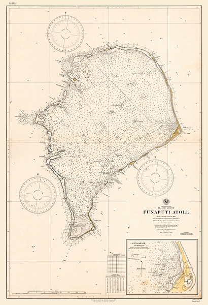
1896 Map of Funafuti Atoll Tuvalu – Vintage Pacific Ocean Scientific Survey Map Reproduction Featuring Coral Reef Structures Islands and British Expeditions to the South Pacific
History In Your Home
6
1839 Geometrical Map of Tuscany Italy – Scientific Survey Map of Pre-Unification Italy Showing Regional Borders and Landscape During the Grand Duchy of Tuscany Period
History In Your Home
6
1891 Geological Map of California – Late 19th Century Scientific Survey Showing Rock Types Fault Lines and Resource Zones Amidst the State’s Rapid Development and Industrial Ambitions
History In Your Home
6
1857 Lt. Warren’s Map of the Trans-Mississippi West – Military Reconnaissance Survey Depicting Rivers Terrain and Routes Across the Frontier West Before the Civil War
History In Your Home
1879 Topographical Map of the American West – Survey Map Depicting Elevation Rivers and Mountain Ranges Across Western Territories During the Age of Railroad Expansion
History In Your Home
1930 Survey Map of Montana – Detailed U.S. Geological and Topographic Survey Showing Mountain Ranges Rivers Roads and Settlements Reflecting Early 20th-Century Western Expansion Geography and Land Development
History In Your Home
1883 Map of Volusia County Florida – Historic Land Survey Showing Early Settlements Railroads and Township Divisions During Florida’s 19th Century Expansion Era
History In Your Home
1879 Wheeler Survey Map – West of the Mississippi – Military & Topographical Public Lands Advancement – American Frontier History Survey
History In Your Home
1911 Geological Map of Wisconsin – Early 20th Century Survey of Bedrock Mineral Deposits and Glacial Formations Across the State
History In Your Home
Geological Map of Fiji Islands – Detailed 20th Century Geological Survey Map Showing Volcanic Formations Mountain Ranges Mineral Deposits Rivers Coastal Areas and Topography Across the Fiji Archipelago
History In Your Home
1884 Forest Map of the United States – Early Federal Survey Depicting National Woodland Coverage Timber Resources and Vegetation Distribution Before the Advent of Conservation Policy
History In Your Home
6
1968 Geological Map of Kuwait – Detailed Oil-Era Geological Survey Showing Subsurface Formations Sedimentary Basins and Key Energy Resources in a Strategic Middle Eastern State
History In Your Home
6
1922 Map of Snohomish County Washington – Detailed Township and Range Survey Railroads and Settlements in Early 20th Century Pacific Northwest
History In Your Home
Map of Original Village Lot Grants – Dutch West India Company Survey of New Amsterdam Showing Early Land Distribution Colonial Urban Planning and 17th Century Dutch Settlement in New York
History In Your Home
1890 Survey Map of Palestine – Late Ottoman-Era Topographical Map Documenting Villages Terrain Features and Infrastructure During a Time of Increasing Western Archaeological and Colonial Interest
History In Your Home
6
Geological Map of Ireland – Rock Strata Mineral Deposits and Terrain Features Based on 19th Century British Geological Survey
History In Your Home
6
1867 Keeler Survey Map of the American West – Post-Civil War Cartographic Snapshot of Western Territories During U.S. Expansion Railroad Growth and Native Displacement Across the Frontier
History In Your Home
6
1905 Official Map of Miami Florida – First City Engineer Plan Showing Pre-Drainage Landscape Henry Flagler’s Railway & Biscayne Bay
History In Your Home
6
1943 Survey Map of La Jolla California – Mid-20th Century Topographic and Coastal Development Map Documenting Urban Growth During Wartime in Southern California
History In Your Home
1897 Map of Los Altos Hills California – Rare Pre-Development Land Survey Showing Ranchos Roads and Early Property Divisions in Santa Clara County Before Suburban Growth
History In Your Home
1784 Map Showing the Course of the Ganges and Ghaghara Rivers – Detailed Riverine Survey Conducted During British Colonial Expansion in Northern India with Settlements and Tributary Features
History In Your Home
6
1948 Topographic Map of Grand Canyon – Postwar Survey of Arizona’s Iconic National Park Detailing Elevation Rock Layers and Trail Systems in One of America’s Greatest Natural Wonders
History In Your Home
6
1942 Map of Hadera – Historic British Mandate-Era Survey Chart of a Coastal Town in the Holy Land Showing Infrastructure and Regional Layout
History In Your Home
1850 Map of Benicia California – Early Statehood-Era Survey Showing Streets Waterfront and Infrastructure in the City Briefly Serving as the Capital During California’s Gold Rush Boom
History In Your Home
1897 Geological Map of Ecuador – Scientific Survey Showing the Volcanic Zones Fault Lines and Topographic Features of the Andes Mountains and the Pacific Ring of Fire in South America
History In Your Home
1872 Geological Map of France – Detailed 19th Century Scientific Survey of Rock Formations Fault Lines and Mineral Zones During a Key Period in European Earth Science Advancement
History In Your Home
6
1925 Map of the Great Barrier Reef – Australian Maritime Survey Depicting Coral Formations Reef Channels and Early Navigation Routes Along the Queensland Coast
History In Your Home
6
1912 Map of Coral Reefs in the South Pacific Australia and the Philippines – Early Marine Survey of Oceanic Coral Formations for Scientific Navigational and Colonial Exploration Use
History In Your Home
Geological Survey Map of Remote Gough Island in the South Atlantic Ocean Documenting Volcanic Formations Geological Layers and Seismic Activity of This Isolated British Overseas Territory
History In Your Home
6
1881 Geological Map of Algeria – French Colonial-Era Survey Depicting Subsurface Structures Rock Formations and Mineral Resources During the Height of European Scientific Exploration in North Africa
History In Your Home
6
1874 Geological Map of Texas – Reconstruction-Era Survey Depicting Rock Formations Mineral Zones and Surface Features Amid Growing Scientific and Industrial Interest in the American Southwest
History In Your Home
6
1874 Geological Map of the Black Hills – Early Scientific Survey of Mineral Deposits and Terrain in the Dakota Territory During the Gold Rush Era
History In Your Home
1868 Rancho Manuscript Survey Map of Los Angeles Showing Property Boundaries Land Grants and Early Settlements During the Spanish and Mexican Land Grant Era in Southern California
History In Your Home
1869 Ordnance Survey Map of the Sinai Peninsula – British Survey Depicting Routes Oases and Biblical Topography of the Region Linking Africa and Asia During the Suez Canal Era
History In Your Home
6
1955 Geological Map of France – Mid-20th Century Scientific Survey Charting Rock Formations Fault Zones and Mineral Resources During the Postwar Rebuilding and Industrial Modernization of Europe
History In Your Home
Print One
Plant One
One tree planted for every print.
Pictorem supports Trees for the Future, a 501(c)3 non-profit organization, that operates an agroforesty program to restore trees to degraded lands by working with smallholder farmers.
MORE INFO
EMAIL
PASSWORD
CREATE AN ACCOUNT
FORGOT YOUR PASSWORD?
×
CREATE ACCOUNT
USERNAME
EMAIL
PASSWORD
CONFIRM PASSWORD
ALREADY HAVE AN ACCOUNT?
FORGOT YOUR USER ACCOUNT DETAILS?
USERNAME OR EMAIL
AAH, WAIT, I REMEMBER NOW!
×
TOP
Send
Please wait...