Free Shipping in Continental USA & Canada -
No Extra fees
LOGIN
EN |
FR
FRANCAIS
$
FORMATS & PRICES
ART GALLERY
ABOUT US
TOOLS
SUPPORT
PRO & ARTISTS
CONTACT US
HOME
COLLECTION
SCENIC
AI WALL ART GENERATOR
LIFESTYLE
BEST SELLERS
LANDSCAPES
VINTAGE POSTERS
1X COLLECTION
BOTANICAL
MINIMALISM
OLD MASTERS & POPULAR PAINTING
WILDLIFE
CITYSCAPES
TYPOGRAPHY
POP
STYLES
ABSTRACT
AI
AIGALLERY
DRAWINGS-ABSTRACT
DRAWINGS-FINEART
DRAWINGS-GRAFFITI
DRAWINGS-ILLUSTRATION
PAINTING
PHOTOGRAPHY-ABSTRACT
PHOTOGRAPHY-LANDSCAPE
PHOTOGRAPHY-PORTRAIT
PHOTOGRAPHY-SURREALISM
VINTAGE-POSTERS
FEATURED
BEST SELLERS
EXPLORE
ROOMS
Bar
Basement
Bathroom
Bedroom
Dining Room
Game Room
Garage
Gym
Hallway
Kid's room
Kitchen
Living room
Nursery
Office
ARTISTS
SELL YOUR ART
MY CART
View Cart
Checkout
COLLECTION
STYLES
FEATURED
TOP SALES
EXPLORE
ROOMS
ARTISTS
SELL
SCENIC
AI WALL ART GENERATOR
LIFESTYLE
BEST SELLERS
LANDSCAPES
VINTAGE POSTERS
1X COLLECTION
BOTANICAL
MINIMALISM
OLD MASTERS & POPULAR PAINTING
WILDLIFE
CITYSCAPES
TYPOGRAPHY
POP
Bar
Basement
Bathroom
Bedroom
Dining Room
Game Room
Garage
Gym
Hallway
Kid's room
Kitchen
Living room
Nursery
Office
ABSTRACT
AI
AIGALLERY
DRAWINGS-ABSTRACT
DRAWINGS-FINEART
DRAWINGS-GRAFFITI
DRAWINGS-ILLUSTRATION
PAINTING
PHOTOGRAPHY-ABSTRACT
PHOTOGRAPHY-LANDSCAPE
PHOTOGRAPHY-PORTRAIT
PHOTOGRAPHY-SURREALISM
VINTAGE-POSTERS
Collection
by Style
by Shape
by Color
by Room
Artists
COLLECTION
Scenic
AI Wall Art Generator
Lifestyle
Best Sellers
Landscapes
Vintage Posters
1X Collection
Botanical
Minimalism
Old Masters & Popular painting
Wildlife
Cityscapes
Typography
Pop
Filter by Style
Abstract
(119.2k)
Ai
(84.2k)
AIGALLERY
(29.2k)
drawings-abstract
(19.5k)
drawings-fineart
(25k)
drawings-graffiti
(2.6k)
drawings-illustration
(57.8k)
painting
(232k)
photography-abstract
(38.4k)
photography-landscape
(306.9k)
photography-portrait
(38.2k)
photography-surrealism
(21.3k)
Vintage-Posters
(51k)
Filter by Shape
Landscape
Panoramic
Vertical
Square
Filter by Color
Filter by Room
Bar
Basement
Bathroom
Bedroom
Dining Room
Game Room
Garage
Gym
Hallway
Kid's room
Kitchen
Living room
Nursery
Office
Art Selection for Resellers
sort by:
Featured
Most Popular
Most Liked
Most Recent
Keyword: Middle East
×
Many Hands Holding A Dove
PacificStock
the restoration of bettie page 01 04 20 master publication
corneakkers
ASF040
L art de l image et de l expression
1561 Giacomo Gastaldi Map of the Middle East – Renaissance Cartography Depicting Ottoman Territories Cities Trade Routes and European Knowledge of the Region
History In Your Home
Bridge In Lake District Cumbria England
PacificStock
9
1973 Yom Kippur War Map – Strategic Cartographic Overview of Israeli and Arab Military Positions During the Fourth Arab–Israeli War on the Sinai and Golan Fronts
History In Your Home
1961 Map of the Hashemite Kingdom of Jordan – Mid-20th Century Middle East Map Depicting Districts Topography Roads and Borders During a Period of Regional Tension and Development
History In Your Home
6
1848 French Map of the Middle East – Vintage Cartographic Depiction of Ottoman Territories Holy Sites and Political Borders During the 19th Century in the Eastern Mediterranean
History In Your Home
6
1904 Map of Lebanon Depicting Ottoman-Era Administrative Divisions and Coastal Geography Prior to French Mandate Rule in the Middle East
History In Your Home
1917 Map of Palestine Depicting Ottoman-Era Territories and Strategic Military Zones During the Final Year of World War I in the Middle East
History In Your Home
6
1965 Map of Kuwait and Basreh – Cold War-Era Middle East Map Depicting Strategic Oil Regions Coastal Cities & Political Geography Before Modern Conflict
History In Your Home
6
1949 Map of Beirut Lebanon – Post-WWII Middle East Urban Map Showing City Districts Landmarks and Urbanization in Early Modern Lebanon
History In Your Home
7
1978 IDF Military Map of the Middle East – Regional Political and Geographical Map Featuring Israel and Neighboring Countries During a Time of Geopolitical Tension and Shifting Alliances
History In Your Home
1816 Aaron Arrowsmith Map of the Middle East Showing Regional Borders Deserts and Major Trade Routes from the Ottoman Empire Through Persia to the Arabian Peninsula
History In Your Home
Cowboy Boot Heel And Spur In Saddle Stirrup
PacificStock
6
1951 Map of Baghdad Iraq – Mid-20th Century City Map Depicting Streets Districts Tigris River and Urban Layout During Iraq’s Monarchical Period
History In Your Home
7
Great Sphinx on the Giza plateau. Egypt August 2021
Vitaliy Borisov
6
1930 Map of the Persian Gulf – Historical Maritime Navigation Chart Showing Coastal Settlements Islands and Trade Routes in the Gulf Region During the Interwar Period
History In Your Home
Geological Map of the Arabian Peninsula – Vintage Scientific Survey Depicting Rock Formations Fault Lines and Mineral Resources Across the Middle East’s Largest Landmass
History In Your Home
1994 Map of the Sultanate of Oman – Late 20th Century Middle East Map Depicting Provinces Mountains Roads and Coastal Geography During Omans Modernization Period
History In Your Home
Map of the Ruins of Babylon – Historic Archaeological Cartography Reproduction | 19th Century Map Depicting Ancient Mesopotamian City on the Euphrates
History In Your Home
6
1918 Sunni and Shia Muslim Population Map of Arabia – Vintage Middle East Religious Distribution Map | Historic Ethnographic Cartography Showing Islamic Sects in Arabian Peninsula During WWI Era
History In Your Home
6
1973 Geological Map of Iran – Updated Scientific Cartography Showing Structural Formations and Natural Resource Zones Amidst Post-Industrial Energy Exploration in the Middle East
History In Your Home
6
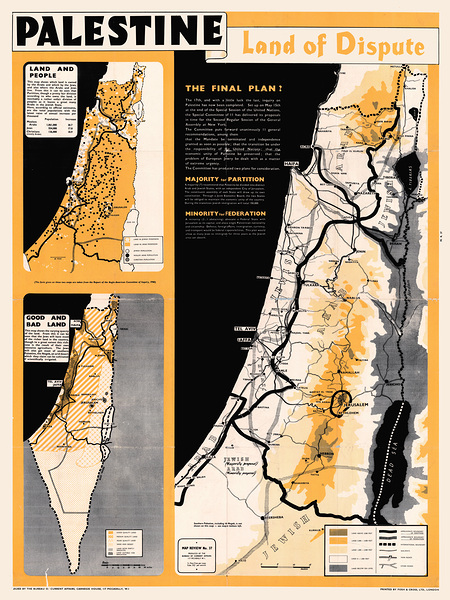
1947 Partition Map of Palestine – Historical Political Boundaries and United Nations Proposal Leading to the Founding of Israel
History In Your Home
1977 Soviet Map of Syria Showing Political Boundaries Transportation Networks and Strategic Points During the Cold War Era of Soviet Influence in the Middle East
History In Your Home
1874 Geological Map of the Dead Sea Showing Rock Strata Elevation and Subterranean Features of the Jordan Rift Valley During the Era of Biblical Geography and Scientific Exploration
History In Your Home
1942 Top Secret Military Map – Free French Forces Chart of Syria and Lebanon Used in Allied Intelligence Operations During the Middle East Theater of World War II
History In Your Home
9
A.P.Polo - Chess
A P Polo
1956 Pictorial Map of Iraq Showing Cities Resources and Cultural Highlights During the Early Years of the Iraqi Republic Following the End of the British Mandate
History In Your Home
1910 Ottoman Survey Map of the Iraq–Iran Border – Detailed Regional Map Depicting Settlements Rivers and Terrain Reflecting Late Ottoman Administrative Geography and Early 20th-Century Political Boundaries in the Middle East
History In Your Home
Planting new rice;Chiang mai thailand
PacificStock
Civil War Cannon 1st East Tennessee US Artillery
Shelia Hunt Photography
Northumberland, England; An Open Bible At The Back Of A Church
PacificStock
Northumberland, England; An Open Bible At The Back Of A Church
PacificStock
Durham, England; An Open Bible At The Back Of A Church
PacificStock
Historic Desert Fortress Architecture at Sunset in the Middle East
AME
6
Middle East Skyline
Conceptual Photography
6
1948 Israel Declaration of Independence – Historic Reproduction of Founding Document Proclaiming the Establishment of the Modern State of Israel After British Mandate Rule
History In Your Home
10
1944 Map of Nazareth – Historical British Mandate Survey Chart Showing Urban Structure Roads and Topography in the Holy Land During WWII
History In Your Home
15
1963 Military Map of the Yemen Arab Republic – Cold War-Era Map Depicting Civil War Battle Zones Tribal Regions and Strategic Terrain During the North Yemen Conflict
History In Your Home
6
Geological Map of Palestine – Scientific Survey Map Showing Geological Formations Fault Lines and Terrain Features of the Holy Land Based on Early 20th Century British Research
History In Your Home
6
1986 United Arab Emirates Map – Political Map Featuring Abu Dhabi Dubai and Other Emirates During the Late 20th Century Oil Boom and Urban Expansion of the UAE
History In Your Home
Print One
Plant One
One tree planted for every print.
Pictorem supports Trees for the Future, a 501(c)3 non-profit organization, that operates an agroforesty program to restore trees to degraded lands by working with smallholder farmers.
MORE INFO
EMAIL
PASSWORD
CREATE AN ACCOUNT
FORGOT YOUR PASSWORD?
×
CREATE ACCOUNT
USERNAME
EMAIL
PASSWORD
CONFIRM PASSWORD
ALREADY HAVE AN ACCOUNT?
FORGOT YOUR USER ACCOUNT DETAILS?
USERNAME OR EMAIL
AAH, WAIT, I REMEMBER NOW!
×
TOP
Send
Please wait...