Free Shipping in Continental USA & Canada -
No Extra fees
LOGIN
EN |
FR
FRANCAIS
$
FORMATS & PRICES
ART GALLERY
ABOUT US
TOOLS
SUPPORT
PRO & ARTISTS
CONTACT US
HOME
COLLECTION
SCENIC
AI WALL ART GENERATOR
LIFESTYLE
BEST SELLERS
LANDSCAPES
VINTAGE POSTERS
1X COLLECTION
BOTANICAL
MINIMALISM
OLD MASTERS & POPULAR PAINTING
WILDLIFE
CITYSCAPES
TYPOGRAPHY
POP
STYLES
ABSTRACT
AI
AIGALLERY
DRAWINGS-ABSTRACT
DRAWINGS-FINEART
DRAWINGS-GRAFFITI
DRAWINGS-ILLUSTRATION
PAINTING
PHOTOGRAPHY-ABSTRACT
PHOTOGRAPHY-LANDSCAPE
PHOTOGRAPHY-PORTRAIT
PHOTOGRAPHY-SURREALISM
VINTAGE-POSTERS
FEATURED
BEST SELLERS
EXPLORE
ROOMS
Bar
Basement
Bathroom
Bedroom
Dining Room
Game Room
Garage
Gym
Hallway
Kid's room
Kitchen
Living room
Nursery
Office
ARTISTS
SELL YOUR ART
MY CART
View Cart
Checkout
COLLECTION
STYLES
FEATURED
TOP SALES
EXPLORE
ROOMS
ARTISTS
SELL
SCENIC
AI WALL ART GENERATOR
LIFESTYLE
BEST SELLERS
LANDSCAPES
VINTAGE POSTERS
1X COLLECTION
BOTANICAL
MINIMALISM
OLD MASTERS & POPULAR PAINTING
WILDLIFE
CITYSCAPES
TYPOGRAPHY
POP
Bar
Basement
Bathroom
Bedroom
Dining Room
Game Room
Garage
Gym
Hallway
Kid's room
Kitchen
Living room
Nursery
Office
ABSTRACT
AI
AIGALLERY
DRAWINGS-ABSTRACT
DRAWINGS-FINEART
DRAWINGS-GRAFFITI
DRAWINGS-ILLUSTRATION
PAINTING
PHOTOGRAPHY-ABSTRACT
PHOTOGRAPHY-LANDSCAPE
PHOTOGRAPHY-PORTRAIT
PHOTOGRAPHY-SURREALISM
VINTAGE-POSTERS
Collection
by Style
by Shape
by Color
by Room
Artists
COLLECTION
Scenic
AI Wall Art Generator
Lifestyle
Best Sellers
Landscapes
Vintage Posters
1X Collection
Botanical
Minimalism
Old Masters & Popular painting
Wildlife
Cityscapes
Typography
Pop
Filter by Style
Abstract
(119.2k)
Ai
(84.2k)
AIGALLERY
(29.2k)
drawings-abstract
(19.5k)
drawings-fineart
(25k)
drawings-graffiti
(2.6k)
drawings-illustration
(57.8k)
painting
(232k)
photography-abstract
(38.4k)
photography-landscape
(306.9k)
photography-portrait
(38.2k)
photography-surrealism
(21.3k)
Vintage-Posters
(51k)
Filter by Shape
Landscape
Panoramic
Vertical
Square
Filter by Color
Filter by Room
Bar
Basement
Bathroom
Bedroom
Dining Room
Game Room
Garage
Gym
Hallway
Kid's room
Kitchen
Living room
Nursery
Office
Art Selection for Resellers
sort by:
Featured
Most Popular
Most Liked
Most Recent
Keyword: GEOLOGY
×
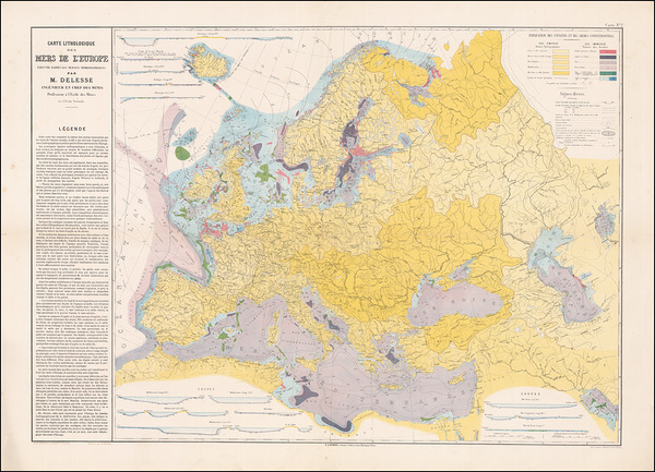
1872 Geological Map of Europe – Comprehensive 19th Century Survey Showing Continental Rock Formations Tectonic Zones and Early Scientific Understanding of European Geology
History In Your Home
1920 Geological Map of Texas – Historical Earth Science Chart Showing Rock Formations Mineral Deposits and Subsurface Geology of Texas During the Early Petroleum Exploration Boom
History In Your Home
6
1955 Geological Map of France – Mid-20th Century Scientific Survey Charting Rock Formations Fault Zones and Mineral Resources During the Postwar Rebuilding and Industrial Modernization of Europe
History In Your Home
6
1881 Geological Map of Algeria – French Colonial-Era Survey Depicting Subsurface Structures Rock Formations and Mineral Resources During the Height of European Scientific Exploration in North Africa
History In Your Home
Geological Map of the Arabian Peninsula – Vintage Scientific Survey Depicting Rock Formations Fault Lines and Mineral Resources Across the Middle East’s Largest Landmass
History In Your Home
1932 Geological Map of the United States – Historic Scientific Cartography Featuring Rock Formations Fault Lines & Natural Resources Across 20th Century America
History In Your Home
6
1974 Geological Map of the United States – Scientific Overview of U.S. Bedrock Formations Fault Lines and Regional Geology Reflecting Mid-20th Century Earth Science Advancements
History In Your Home
6
1909 Geological Map of Florida – Early 20th Century Survey Charting Subsurface Formations Karst Landscapes and Aquifer Systems Before Widespread Development and Modern Environmental Study
History In Your Home
6
1840 Geological Map of Greece – Early Geological Survey Illustrating Tectonic Features Mountain Formations and Ancient Rock Strata in the Cradle of Western Civilization
History In Your Home
6
1855 Geological Map of Ireland – Mid-19th Century Survey Charting the Emerald Isle’s Rock Layers Mineral Resources and Regional Tectonics During Early Geological Exploration in the British Isles
History In Your Home
6
1939 Geological Map of Louisiana – Pre-WWII Survey Charting Coastal and Inland Rock Formations Oil Fields and Sedimentary Structures Amidst the State’s Growing Energy Exploration Economy
History In Your Home
6
1878 Geological Map of the British Isles – Detailed Scientific Chart Illustrating Rock Strata Fault Lines and Mineral Resources Across England Scotland Ireland and Wales During the Victorian Era
History In Your Home
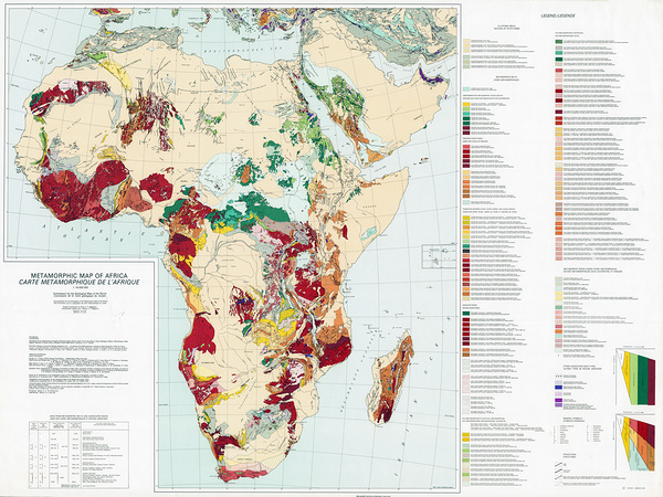
Metamorphic Map of Africa – Geological Formations Showing Rock Types Mineral Zones Mountain Belts Tectonic History & Regional Geology
History In Your Home
1893 Geological Chart – Historic Earth Science Diagram Showing Rock Strata Layers of the Earths Crust and the Classification of Sedimentary Igneous and Metamorphic Formations
History In Your Home
1875 Geological Map of the World – Historic Global Earth Science Map Reproduction | 19th Century Geological Features Rock Formations & Continental Stratigraphy
History In Your Home
6
1959 Geological Map of Iran – Mid-20th Century Geological Survey Documenting Iran’s Complex Tectonic Structures Oil-Bearing Formations and Mineral Resources During Global Energy Transitions
History In Your Home
6
1973 Geological Map of Iran – Updated Scientific Cartography Showing Structural Formations and Natural Resource Zones Amidst Post-Industrial Energy Exploration in the Middle East
History In Your Home
6
1956 Soviet Geological Map of Ukraine and Moldova – Cold War-Era Survey Detailing Regional Stratigraphy Mineral Wealth and Subsurface Structure Under Soviet Resource Planning
History In Your Home
6
1874 Geological Map of Texas – Reconstruction-Era Survey Depicting Rock Formations Mineral Zones and Surface Features Amid Growing Scientific and Industrial Interest in the American Southwest
History In Your Home
6
1878 Geological Map of Northwestern Wyoming – Detailed U.S. Geological Survey Focused on Jackson Hole and Surrounding Mountain Ranges During the Hayden Expedition Era
History In Your Home
Detailed Geological Map of Switzerland Highlighting Alpine Formations Rock Strata Tectonic Structures and Regional Geology Relevant to Swiss Topography and Natural Resources
History In Your Home
Geological Map of Uruguay Displaying Mineral Resources Rock Formations and Regional Fault Lines—Used for Industrial and Academic Study in South America’s Southern Cone
History In Your Home
1965 Geological Map of Ohio Showing Bedrock Composition Mineral Resources and Geological Features Across the Midwest During the Postwar Industrial Era
History In Your Home
1898 Geological Map of the Isle of Man Showing Rock Formations Fault Lines Coastal Topography and Geological Structures of the Island in the Irish Sea
History In Your Home
6
Geological Map of Asia – Vintage Scientific Cartography of Asian Geology | Historic Depiction of Tectonic Plates Mineral Zones & Rock Formations Across the Asian Continent
History In Your Home
6
1968 Geological Map of Kuwait – Detailed Oil-Era Geological Survey Showing Subsurface Formations Sedimentary Basins and Key Energy Resources in a Strategic Middle Eastern State
History In Your Home
1878 Geological Diagram of the Earths Crust – Victorian-Era Educational Illustration Showing Stratification Rock Layers and Subsurface Structure Based on 19th Century Geological Understanding
History In Your Home
6
1891 Geological Map of California – Late 19th Century Scientific Survey Showing Rock Types Fault Lines and Resource Zones Amidst the State’s Rapid Development and Industrial Ambitions
History In Your Home
6
1858 Geological Map of the Southwestern United States – First Scientific Mapping of the Colorado River Region and Surrounding Plateaus
History In Your Home
Geological Map of Paris – Subsurface Rock Layers Mineral Composition and Topographic Data Beneath the French Capital During the 19th Century
History In Your Home
1991 Geological Map of Honduras – Scientific Cartographic Representation Showing Tectonic Structures Fault Zones Rock Formations and Natural Resource Deposits Across Central America
History In Your Home
Geological Map of Brazil Depicting Major Mineral Zones Amazonian Geologic Features and Coastal Plate Tectonics—A Key Tool in Early 20th Century Scientific Research
History In Your Home
Geological Map of the Bolivian Andes Highlighting Tectonic Faults Mineral Zones and Andean Uplift Formations Used in Scientific Research and Mining Exploration
History In Your Home
Geological Map of Nigeria Highlighting Mineral Deposits Fault Lines and Stratigraphic Formations—Created for Academic Research and Resource Exploration in West Africa
History In Your Home
Geological Map of Colorado Showing Rock Formations Fault Lines Mineral Resources and Mountain Ranges for Scientific Industrial and Educational Purposes
History In Your Home
Detailed Cross-Section Geological Diagram – Scientific Illustration Showing Stratified Rock Layers Crustal Structure Fault Lines Sedimentary Deposits Volcanic Zones & Subsurface Geological Formations
History In Your Home
6
1872 Geological Map of the United States – Vintage 19th Century Earth Science Chart Depicting Rock Formations Terrain and Natural Resources Across the American Landscape
History In Your Home
6
Geological Map of Palestine – Scientific Survey Map Showing Geological Formations Fault Lines and Terrain Features of the Holy Land Based on Early 20th Century British Research
History In Your Home
6
1916 Geological Map of the Navajo Country – Scientific Map Depicting Rock Formations Canyons and Resources Across Arizona New Mexico and Utah
History In Your Home
6
1854 Paleontology Map of the United Kingdom – Foundational Geological Chart Mapping Fossil Distribution Across Britain During the Height of Victorian Scientific Discovery
History In Your Home
6
1926 Tectonic Map of the World – Foundational Global Geoscientific Diagram Depicting Plate Boundaries Fault Zones and Crustal Movements Before Plate Tectonics Was Widely Accepted
History In Your Home
1872 Geological Map of France – Detailed 19th Century Scientific Survey of Rock Formations Fault Lines and Mineral Zones During a Key Period in European Earth Science Advancement
History In Your Home
Print One
Plant One
One tree planted for every print.
Pictorem supports Trees for the Future, a 501(c)3 non-profit organization, that operates an agroforesty program to restore trees to degraded lands by working with smallholder farmers.
MORE INFO
EMAIL
PASSWORD
CREATE AN ACCOUNT
FORGOT YOUR PASSWORD?
×
CREATE ACCOUNT
USERNAME
EMAIL
PASSWORD
CONFIRM PASSWORD
ALREADY HAVE AN ACCOUNT?
FORGOT YOUR USER ACCOUNT DETAILS?
USERNAME OR EMAIL
AAH, WAIT, I REMEMBER NOW!
×
TOP
Send
Please wait...