Free Shipping in Continental USA & Canada -
No Extra fees
LOGIN
EN |
FR
FRANCAIS
$
FORMATS & PRICES
ART GALLERY
ABOUT US
TOOLS
SUPPORT
PRO & ARTISTS
CONTACT US
HOME
COLLECTION
SCENIC
AI WALL ART GENERATOR
LIFESTYLE
BEST SELLERS
LANDSCAPES
VINTAGE POSTERS
1X COLLECTION
BOTANICAL
MINIMALISM
OLD MASTERS & POPULAR PAINTING
WILDLIFE
CITYSCAPES
TYPOGRAPHY
POP
STYLES
ABSTRACT
AI
AIGALLERY
DRAWINGS-ABSTRACT
DRAWINGS-FINEART
DRAWINGS-GRAFFITI
DRAWINGS-ILLUSTRATION
PAINTING
PHOTOGRAPHY-ABSTRACT
PHOTOGRAPHY-LANDSCAPE
PHOTOGRAPHY-PORTRAIT
PHOTOGRAPHY-SURREALISM
VINTAGE-POSTERS
FEATURED
BEST SELLERS
EXPLORE
ROOMS
Bar
Basement
Bathroom
Bedroom
Dining Room
Game Room
Garage
Gym
Hallway
Kid's room
Kitchen
Living room
Nursery
Office
ARTISTS
SELL YOUR ART
MY CART
View Cart
Checkout
COLLECTION
STYLES
FEATURED
TOP SALES
EXPLORE
ROOMS
ARTISTS
SELL
SCENIC
AI WALL ART GENERATOR
LIFESTYLE
BEST SELLERS
LANDSCAPES
VINTAGE POSTERS
1X COLLECTION
BOTANICAL
MINIMALISM
OLD MASTERS & POPULAR PAINTING
WILDLIFE
CITYSCAPES
TYPOGRAPHY
POP
Bar
Basement
Bathroom
Bedroom
Dining Room
Game Room
Garage
Gym
Hallway
Kid's room
Kitchen
Living room
Nursery
Office
ABSTRACT
AI
AIGALLERY
DRAWINGS-ABSTRACT
DRAWINGS-FINEART
DRAWINGS-GRAFFITI
DRAWINGS-ILLUSTRATION
PAINTING
PHOTOGRAPHY-ABSTRACT
PHOTOGRAPHY-LANDSCAPE
PHOTOGRAPHY-PORTRAIT
PHOTOGRAPHY-SURREALISM
VINTAGE-POSTERS
Collection
by Style
by Shape
by Color
by Room
Artists
COLLECTION
Scenic
AI Wall Art Generator
Lifestyle
Best Sellers
Landscapes
Vintage Posters
1X Collection
Botanical
Minimalism
Old Masters & Popular painting
Wildlife
Cityscapes
Typography
Pop
Filter by Style
Abstract
(119.2k)
Ai
(84.2k)
AIGALLERY
(29.2k)
drawings-abstract
(19.5k)
drawings-fineart
(25k)
drawings-graffiti
(2.6k)
drawings-illustration
(57.8k)
painting
(232k)
photography-abstract
(38.4k)
photography-landscape
(306.9k)
photography-portrait
(38.2k)
photography-surrealism
(21.3k)
Vintage-Posters
(51k)
Filter by Shape
Landscape
Panoramic
Vertical
Square
Filter by Color
Filter by Room
Bar
Basement
Bathroom
Bedroom
Dining Room
Game Room
Garage
Gym
Hallway
Kid's room
Kitchen
Living room
Nursery
Office
Art Selection for Resellers
sort by:
Featured
Most Popular
Most Liked
Most Recent
Keyword: Forts
×
Military Map of the 1777 Battle of Forts Clinton and Montgomery – Revolutionary War Era Map Detailing Strategic Positions Fortifications Troop Movements River Crossings and Battle Engagements during the American Revolution
History In Your Home
6
Map of Española with the Columbine Forts and settlements. From the book Life of Christopher Columbus by Clements R. Markham published 1892.
PacificStock
Map of The American Colonies and Canada, showing the British Forts in 1755. From The Story of England, published 1930.
PacificStock
10
Charles Fort Needhams Point Barbados - Circa 2009. Charles Fort was erected in 1650 and is the largest of the forts built around the island that were used to defend it from enemy forces.
Eric Franks
Charles Fort Needhams Point Barbados - Circa 2009. Charles Fort was erected in 1650 and is the largest of the forts built around the island that were used to defend it from enemy forces.
Eric Franks
1898 Military Map of Puerto Rico – Vintage Spanish-American War Map | Historic U.S. Invasion Routes Spanish Forts and Key Geographic Features of the Puerto Rican Campaign
History In Your Home
6
1839 Map of Cape Fear North Carolina – Early Maritime and Settlement Map Showing Coastal Forts Inlets and Riverways in the Pre-Civil War American South
History In Your Home
Map of Roman Britain – Historical Map Illustrating the Roman Provinces Roads Forts Settlements Rivers Military Installations and Urban Centers Across Britain During Roman Occupation
History In Your Home
1849 Map of Punjab During the Final Year of the Sikh Empire—Depicting Territories Forts and Political Borders Just Before British Annexation Following the Second Anglo-Sikh War
History In Your Home
6
1846 Military Map of the Dade Massacre – Second Seminole War Battle Site in Florida Showing Troop Movements Forts and Native Territory
History In Your Home
1880 Military and Maritime Map of Spain – Comprehensive 19th Century Map Highlighting Spain’s Coastal Defenses Naval Installations Ports Forts and Strategic Geography
History In Your Home
1667 Map of Normandy France Showing Provincial Divisions Coastal Forts and Historic Towns During the Reign of Louis XIV and the Height of French Absolutism
History In Your Home
6
1858 Sea Chart Map of Macau – Nautical Map Created During Portuguese Colonial Rule Showing Maritime Routes Coastal Forts and Harbor Depths in the Pearl River Delta of Southern China
History In Your Home
1614 Dutch Map of New Netherlands – Early 17th Century Map Detailing the Dutch Colonial Province of New Netherlands Including Settlements Rivers Forts and Coastal Features Along the Atlantic Coast
History In Your Home
1760 Map of Cap-Haitien Haiti Depicting French Colonial Forts Sugar Plantations and Port Infrastructure in Saint-Domingue During the Peak of Caribbean Plantation Wealth
History In Your Home
1949 Map of Macau – Post-War Colonial-Era Map of the Portuguese-Controlled City in Southern China Showing Urban Layout Forts Churches and Coastal Defenses on the Pearl River Estuary
History In Your Home
6
Jaisalmer Fort one of the largest forts in the world known as
Dmitry Rukhlenko
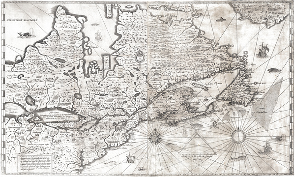
1632 Samuel de Champlain Map of New France – Early 17th Century Map Showing New France Including Quebec the St. Lawrence River Settlements Forts Indigenous Villages Lakes Rivers and Colonial Trade Routes in North America
History In Your Home
1752 Map of Malta and Gozo in the Mediterranean Sea Showing Forts Harbors Towns and Strategic Military Positions of the Knights of St. John Before the Napoleonic Conquests
History In Your Home
1748 Map of the Colony of Georgia the Earliest Obtainable Edition Depicting British Colonial Settlements Coastal Forts and the Southeastern U.S. Frontier During the Colonial Era
History In Your Home
6
1864 Map of the Lower Mississippi River – Civil War-Era Navigation and Strategic Military Chart Showing River Towns Forts and Supply Routes Along the Vital Confederate Waterway
History In Your Home
1655 Map of the New Sweden Colony in America – Early Colonial-Era Map Depicting Swedish Settlements Native Territories River Systems Forts Trade Routes and the Delaware Valley During Scandinavian Expansion in North America
History In Your Home
1885 Sea Chart Map of Mobile Bay Alabama Showing Navigational Depths Buoys Shoals and Coastal Forts Used During the American Civil War Naval Campaigns
History In Your Home
Detailed Ordnance Survey Map of Hadrian’s Wall in Roman Britain Depicting Forts Roads and Ancient Border Defenses Built by the Romans to Guard the Northwestern Frontier of the Empire
History In Your Home
6
1871 Military Map of Paraguay – Strategic War Chart Issued During the War of the Triple Alliance Showing Forts Rivers and Battlefields in One of the Bloodiest Conflicts in Latin American History
History In Your Home
1846 Bruff Map of Florida – Early Statehood Map Issued After the Second Seminole War Depicting Forts Settlements Native Territories and Rivers Reflecting Mid-19th-Century Geography and Military Cartography
History In Your Home
1860 Military Map Depicting English French and Qing Chinese Troop Movements at the Taku Forts During the Third Battle of the Second Opium War A Defining Conflict in 19th Century Imperial Asia
History In Your Home
6
1861 Map of the United States Showing States and Territories on the Eve of the Civil War Including Railroads Forts and Population Centers
History In Your Home
1752 Map of the Gulf Coast and French Louisiana – Colonial-Era Map Depicting Settlements River Systems Coastal Features Forts and Trade Routes Across the Lower Mississippi Valley and Gulf of Mexico
History In Your Home
1881 Map of Havana Cuba – Historic Caribbean City Plan Showing Streets Ports Forts and Spanish Colonial Infrastructure During the Final Decades of Spanish Rule
History In Your Home
6
1849 Map of the Territory of Minnesota Showing Early Settlements Forts and Geographic Features Before Statehood
History In Your Home
1872 Military Map of Dakota Territory – Frontier-Era U.S. War Department Map Showing Forts Tribal Regions Rivers Trails and Strategic Survey Information Prior to Statehood
History In Your Home
1865 Map of the New Mexico Military Department Showing U.S. Forts Military Roads and Native American Territories in the Southwest During the American Civil War
History In Your Home
Knights Walk Rhodes Greece
Fred J Bivetto
1813 Melish Military Map of Southern United States – War of 1812 Theater Showing Mississippi Territory Florida Roads Tribes & Forts
History In Your Home
Une vue du Château de Chenonceau
Daniel Ouellette
1862 G. Arnold Map of the District of Columbia – Detailed Civil War Era Washington DC Map Showing Forts Wards Railroads & Topography
History In Your Home
6
Cannon 23
Eric Franks
Rajasthan Bikaner 150
Jeremy Horner Images
India Rajasthan179
Jeremy Horner Images
India Rajasthan171
Jeremy Horner Images
India Rajasthan147
Jeremy Horner Images
Print One
Plant One
One tree planted for every print.
Pictorem supports Trees for the Future, a 501(c)3 non-profit organization, that operates an agroforesty program to restore trees to degraded lands by working with smallholder farmers.
MORE INFO
EMAIL
PASSWORD
CREATE AN ACCOUNT
FORGOT YOUR PASSWORD?
×
CREATE ACCOUNT
USERNAME
EMAIL
PASSWORD
CONFIRM PASSWORD
ALREADY HAVE AN ACCOUNT?
FORGOT YOUR USER ACCOUNT DETAILS?
USERNAME OR EMAIL
AAH, WAIT, I REMEMBER NOW!
×
TOP
Send
Please wait...