Free Shipping in Continental USA & Canada -
No Extra fees
LOGIN
EN |
FR
FRANCAIS
$
FORMATS & PRICES
ART GALLERY
ABOUT US
TOOLS
SUPPORT
PRO & ARTISTS
CONTACT US
HOME
COLLECTION
SCENIC
AI WALL ART GENERATOR
LIFESTYLE
BEST SELLERS
LANDSCAPES
VINTAGE POSTERS
1X COLLECTION
BOTANICAL
MINIMALISM
OLD MASTERS & POPULAR PAINTING
WILDLIFE
CITYSCAPES
TYPOGRAPHY
POP
STYLES
ABSTRACT
AI
AIGALLERY
DRAWINGS-ABSTRACT
DRAWINGS-FINEART
DRAWINGS-GRAFFITI
DRAWINGS-ILLUSTRATION
PAINTING
PHOTOGRAPHY-ABSTRACT
PHOTOGRAPHY-LANDSCAPE
PHOTOGRAPHY-PORTRAIT
PHOTOGRAPHY-SURREALISM
VINTAGE-POSTERS
FEATURED
BEST SELLERS
EXPLORE
ROOMS
Bar
Basement
Bathroom
Bedroom
Dining Room
Game Room
Garage
Gym
Hallway
Kid's room
Kitchen
Living room
Nursery
Office
ARTISTS
SELL YOUR ART
MY CART
View Cart
Checkout
COLLECTION
STYLES
FEATURED
TOP SALES
EXPLORE
ROOMS
ARTISTS
SELL
SCENIC
AI WALL ART GENERATOR
LIFESTYLE
BEST SELLERS
LANDSCAPES
VINTAGE POSTERS
1X COLLECTION
BOTANICAL
MINIMALISM
OLD MASTERS & POPULAR PAINTING
WILDLIFE
CITYSCAPES
TYPOGRAPHY
POP
Bar
Basement
Bathroom
Bedroom
Dining Room
Game Room
Garage
Gym
Hallway
Kid's room
Kitchen
Living room
Nursery
Office
ABSTRACT
AI
AIGALLERY
DRAWINGS-ABSTRACT
DRAWINGS-FINEART
DRAWINGS-GRAFFITI
DRAWINGS-ILLUSTRATION
PAINTING
PHOTOGRAPHY-ABSTRACT
PHOTOGRAPHY-LANDSCAPE
PHOTOGRAPHY-PORTRAIT
PHOTOGRAPHY-SURREALISM
VINTAGE-POSTERS
Collection
by Style
by Shape
by Color
by Room
Artists
COLLECTION
Scenic
AI Wall Art Generator
Lifestyle
Best Sellers
Landscapes
Vintage Posters
1X Collection
Botanical
Minimalism
Old Masters & Popular painting
Wildlife
Cityscapes
Typography
Pop
Filter by Style
Abstract
(119.2k)
Ai
(84.2k)
AIGALLERY
(29.2k)
drawings-abstract
(19.5k)
drawings-fineart
(25k)
drawings-graffiti
(2.6k)
drawings-illustration
(57.8k)
painting
(232k)
photography-abstract
(38.4k)
photography-landscape
(306.9k)
photography-portrait
(38.2k)
photography-surrealism
(21.3k)
Vintage-Posters
(51k)
Filter by Shape
Landscape
Panoramic
Vertical
Square
Filter by Color
Filter by Room
Bar
Basement
Bathroom
Bedroom
Dining Room
Game Room
Garage
Gym
Hallway
Kid's room
Kitchen
Living room
Nursery
Office
Art Selection for Resellers
sort by:
Featured
Most Popular
Most Liked
Most Recent
Keyword: Administrative
×
A view of Aberystwyth from Constitution Hill
Leighton Collins
6
1927 Map of Cameroon – Colonial-Era Map Showing French and British Administrative Borders Provinces Railways and Geographic Features in Early 20th Century West Africa
History In Your Home
6
1941 Map of Dutch West Timor – Colonial-Era Indonesia Map Showing Towns Topography Administrative Borders and Coastline Prior to Japanese Invasion in World War II
History In Your Home
6
1979 Pictorial Map of the Republic of Georgia – Illustrated Soviet-Era Map Depicting Cultural Icons Landmarks Topography and Administrative Regions of the Caucasus Nation
History In Your Home
1971 Map of Islamabad Pakistan – Vintage Cartographic Reproduction Depicting Pakistan’s New Capital with Administrative Zones Streets Government Buildings & Planned Urban Layout in the Post-Independence Era
History In Your Home
6
1936 Administrative Map of the Soviet Union – Vintage Political Cartography of the USSR | Historic Depiction of Soviet Republics Borders and Internal Divisions Before World War II
History In Your Home
6
1904 Map of Lebanon Depicting Ottoman-Era Administrative Divisions and Coastal Geography Prior to French Mandate Rule in the Middle East
History In Your Home
6
1893 Map of the Ottoman Empire – Late Imperial Survey Showing Administrative Divisions and Political Borders Amidst Decline of One of the Worlds Longest-Lasting Empires in the 19th Century
History In Your Home
6
1896 Map of the Ottoman Empire – Strategic Political Survey Depicting the Administrative and Territorial Structure of the Sultanate Just Before the Dawn of the 20th Century
History In Your Home
1958 Map of Belgian Congo – Colonial-Era Survey of Central Africa Depicting Administrative Regions Resource Zones and Infrastructure During the Final Years of Belgian Rule
History In Your Home
6
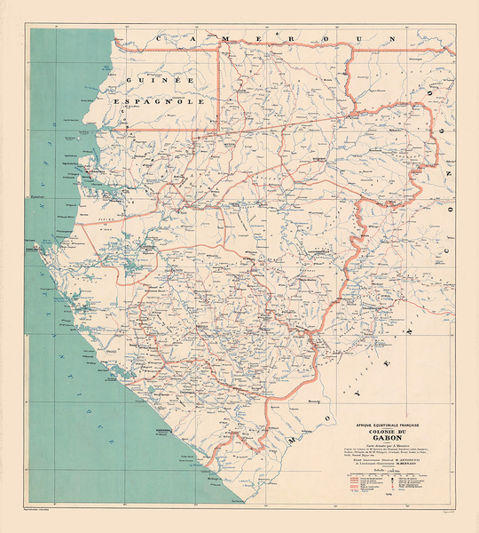
1931 French Colonial Map of Gabon – Early 20th Century Administrative and Geographical Map Showing Territorial Divisions Topography and Trade Routes in Equatorial Africa
History In Your Home
1826 Postal Map of the Habsburg Empire – Early 19th Century Transportation and Communication Map Showing Mail Routes Stagecoach Roads and Administrative Centers Across Central Europe
History In Your Home
1831 Map of Puerto Rico – Spanish Colonial-Era Map Showing Administrative Districts Mountains Coastal Settlements and Roads Before U.S. Annexation in the Spanish-American War
History In Your Home
1958 Map of Cyprus – Pre-Independence Colonial Map of the Mediterranean Island Under British Rule Highlighting Administrative Divisions Ethnic Boundaries and Strategic Military Locations
History In Your Home
1799 Postal Map of France – Late 18th Century Transportation and Communication Routes Showing Post Towns Road Networks and Administrative Divisions at the Close of the Revolutionary Era
History In Your Home
1914 City Plan of Warsaw Under Russian Martial Law – Detailed Map Depicting Streets Military Installations and Administrative Divisions as World War I Began Under Russian Occupation of Poland
History In Your Home
1949 Political and Geographic Map of Norway Displaying Post-War Administrative Divisions Transportation Networks and Natural Features During a Period of Modern Recovery and Reconstruction
History In Your Home
1930 Map of Argentina Highlighting National Borders Administrative Divisions Transportation Infrastructure and Natural Resources During the Country’s Economic Expansion Between the World Wars
History In Your Home
1965 Map of Albania Showing Administrative Divisions Cities Roads and Topography During the Communist Era Under Enver Hoxha’s Regime Including Border Areas with Yugoslavia and Greece
History In Your Home
1930 Map of Turkey Showing Administrative Divisions Major Cities Railways and Ottoman Legacy Infrastructure During the Early Republican Era Under Mustafa Kemal Ataturk’s Modernization Campaign
History In Your Home
1969 Map of Moldova Showing the Administrative Divisions Major Towns River Systems and Regional Identity of the Moldavian SSR Under the Soviet Union Prior to Its 1991 Independence
History In Your Home
1948 Detailed Map of Dhi Qar Governorate in Iraq Depicting Administrative Divisions and Geographic Features from the Post-Mandate Era in the Middle East
History In Your Home
1955 Map of Karbala Governorate Iraq Showing Key Religious Sites Administrative Regions and Cultural Landmarks in the Heart of Shia Islam
History In Your Home
1957 Map of Sulaymaniyah Governorate in Northeastern Iraq Depicting Administrative Boundaries Key Roads Settlements and Regional Topography During Mid-20th Century Iraqi Development
History In Your Home
1904 Map of the Kingdom of Poland Depicting Administrative Divisions Cities and Geographic Features While Under the Rule of the Russian Empire in the Final Decades Before Poland Regained Independence
History In Your Home
1925 Map of Morocco During the Era of French Colonial Rule Depicting Administrative Divisions Trade Routes and Urban Centers of the Maghreb in Early 20th Century North Africa
History In Your Home
1868 Map of Cuba Depicting Colonial Infrastructure Sugar Plantations and Administrative Districts Under Spanish Rule During a Period of Growing Tensions and Reform Movements
History In Your Home
1885 Map of Hungary Showing the Kingdom’s Administrative Divisions Rail Networks and Urban Centers Under Austro-Hungarian Rule Before the Collapse of the Empire
History In Your Home
1895 Map of Ottoman Lebanon Showing Administrative Divisions Mountain Settlements and Religious Communities Under Late 19th Century Turkish Imperial Rule
History In Your Home
1920 Map of Slovakia Showing Ethnic Regions Mountainous Terrain and Administrative Borders Following the Formation of Czechoslovakia After World War I
History In Your Home
1936 Map of Slovakia Showing Administrative Regions Transportation Networks and National Borders During the First Czechoslovak Republic Between World Wars
History In Your Home
1957 Map of Cayenne French Guiana Showing Colonial Districts Administrative Borders and Coastal Settlements During the Final Decades of French Overseas Governance
History In Your Home
1965 Map of Guatemala City Showing Urban Layout Roads and Administrative Divisions During a Period of Rapid Expansion in Mid-20th Century Central America
History In Your Home
1954 Map of Karachi Pakistan Showing Administrative Districts Coastal Infrastructure and Urban Planning Features in the Post-Independence Era
History In Your Home
1813 Map of Swedish Pomerania Depicting Administrative Divisions Towns and Coastlines Under Swedish Control During the Napoleonic Era in Northern Europe
History In Your Home
1808 Map of West Galicia Southern Poland Showing Administrative Divisions and Geographic Features After the Third Partition of Poland During the Napoleonic Era
History In Your Home
1985 Map of Kiev or Kyiv Ukraine Showing City Expansion Administrative Zones and Urban Planning During the Final Decade of the Soviet Era
History In Your Home
1964 Political and Administrative Map of Iraq Showing Provinces Major Cities Infrastructure and National Boundaries During the Era of the Early Iraqi Republic
History In Your Home
1800 Map of the Kyiv Province – Early 19th-Century Map Depicting Cities Towns Rivers Roads and Administrative Borders Reflecting Historical Geography and Political Divisions in Central Ukraine
History In Your Home
1992 Map of Kyiv Oblast – Modern Map Depicting Cities Towns Roads Rivers and Administrative Divisions Reflecting Post-Soviet Geographic Knowledge Political Boundaries and Regional Development in Central Ukraine
History In Your Home
1807 Map of Poland – Napoleonic-Era Territorial Map Showing Provinces Roads Settlements and Administrative Divisions During the Formation of the Duchy of Warsaw and Redrawn Eastern European Borders
History In Your Home
1810 Map of Northern Italy – Napoleonic-Era Regional Map Showing Kingdom Divisions Roads Alpine Passes Cities and Administrative Boundaries During French Imperial Influence Across the Italian Peninsula
History In Your Home
Print One
Plant One
One tree planted for every print.
Pictorem supports Trees for the Future, a 501(c)3 non-profit organization, that operates an agroforesty program to restore trees to degraded lands by working with smallholder farmers.
MORE INFO
EMAIL
PASSWORD
CREATE AN ACCOUNT
FORGOT YOUR PASSWORD?
×
CREATE ACCOUNT
USERNAME
EMAIL
PASSWORD
CONFIRM PASSWORD
ALREADY HAVE AN ACCOUNT?
FORGOT YOUR USER ACCOUNT DETAILS?
USERNAME OR EMAIL
AAH, WAIT, I REMEMBER NOW!
×
TOP
Send
Please wait...